Valley View, Illinois Weather
Issued: 3:57 pm CDT May 8, 2024 Latitude: 41.9661384 Longitude: -88.2989657 View on Google Maps
|
|
|
|
|
|
|
|
|
|
 |
 |
 |
 |
|
 |
 |
|
| Low: °F |
High: °F |
High: °F |
High: °F |
High: °F |
High: °F |
High: °F |
High: °F |
| Low: °F |
Low: °F |
Low: °F |
Low: °F |
Low: °F |
Low: °F |
|
| Thunderstorms |
Thunderstorms |
Mostly Sunny |
Rain |
Mostly Sunny |
Thunderstorms |
Partly Sunny |
Rain |
Current Conditions at
WEST CHICAGO - (KDPA)
77°
Clear
as of 4:52 PM CDST
Rel. Humidity: 33%
Dew Point: 46°F
Visibility: 10 Miles
Pressure: 29.68 in.
Flight Rule: VFR
Wind Data
13 MPH
Gust: 25 MPH
070° East
Cloud Level(s): Clear
Current Conditions at
AURORA - (KARR)
81°
Clear
as of 4:52 PM CDST
Rel. Humidity: 32%
Dew Point: 48°F
Visibility: 10 Miles
Pressure: 29.67 in.
Flight Rule: VFR
Cloud Level(s): Clear
Current Conditions at
CHICAGO-OHARE - (KORD)
75°
Partly Cloudy
as of 4:51 PM CDST
Rel. Humidity: 27%
Dew Point: 39°F
Visibility: 10 Miles
Pressure: 29.69 in.
Flight Rule: VFR
Cloud Level(s): Few at 6500ft, Few at 10000ft, Scattered at 25000ft
Current Conditions at
DE KALB TAYLOR MUNICIPAL - (KDKB)
77°
Partly Cloudy
as of 5:35 PM CDST
Rel. Humidity: 25%
Dew Point: 39°F
Visibility: 10 Miles
Pressure: 29.69 in.
Flight Rule: VFR
Cloud Level(s): Scattered at 8000ft, Scattered at 11000ft
|
Tonight... A chance of showers and thunderstorms, then showers and possibly a thunderstorm after 2am. Low around 52. East northeast wind 10 to 15 mph, with gusts as high as 20 mph. Chance of precipitation is 80%. New rainfall amounts between a tenth and quarter of an inch, except higher amounts possible in thunderstorms. |
|
|
Thursday... Showers and possibly a thunderstorm before 1pm, then showers likely. High near 56. North northeast wind around 15 mph, with gusts as high as 25 mph. Chance of precipitation is 80%. New rainfall amounts between a quarter and half of an inch possible. |
|
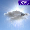 |
Thursday Night... A 30 percent chance of showers, mainly before 7pm. Cloudy, then gradually becoming partly cloudy, with a low around 42. North wind 5 to 10 mph, with gusts as high as 20 mph. |
|
|
Friday... Mostly sunny, with a high near 66. North northwest wind 5 to 10 mph, with gusts as high as 15 mph. |
|
 |
Friday Night... A 40 percent chance of showers, mainly before 1am. Partly cloudy, with a low around 48. West wind 5 to 10 mph, with gusts as high as 15 mph. |
|
|
Saturday... A 20 percent chance of showers after 1pm. Mostly sunny, with a high near 66. |
|
 |
Saturday Night... Mostly clear, with a low around 46. |
|
|
Sunday... Mostly sunny, with a high near 74. |
|
 |
Sunday Night... A chance of showers before 1am. Partly cloudy, with a low around 55. |
|
|
Monday... A chance of showers and thunderstorms after 1pm. Mostly sunny, with a high near 75. |
|
 |
Monday Night... Mostly cloudy, with a low around 54. |
|
|
Tuesday... A chance of showers. Partly sunny, with a high near 76. |
|
 |
Tuesday Night... A chance of showers. Mostly cloudy, with a low around 57. |
|
|
Wednesday... A chance of showers. Mostly sunny, with a high near 78. |
|
Current Radar Image
Sun Almanac for Valley View, Illinois
Sunrise: 05:39 AM
Sunset: 8:00 PM
Civil Sunrise:05:08 AM
Civil Sunset: 8:31 PM
Nautical Sunrise: 04:29 AM
Nautical Sunset: 9:10 PM
Astro Sunrise: 03:47 AM
Astro Sunset: 9:53 PM
Illinois' Current Temperatures
 Illinois' Satellite Image
 Illinois' Current Wind Direction
| National Summary |
of upper and lower values of current conditions amongst 7018 locations
in the contiguous United States |
|
High
Temp |
117° |
Orange Grove Nalf, Texas
|
|
Low
Temp |
32° |
Pagosa Springs, Colorado
and 1 other location
|
|
Wind
Speed |
38mph |
Powell, Wyoming
and 1 other location
|
|
Wind
Gust |
51mph |
Darlington, South Carolina
|
|
Wind
Chill |
20° |
Pagosa Springs, Colorado
|
|
Heat
Index |
118° |
Mcallen, Texas
|
|
High
Pressure |
30.45Hg |
Port Angeles Cga, Washington
and 3 other locations
|
|
Low
Pressure |
29.45Hg |
Poughkeepsie, New York
|
|
| # Locations Reporting Rain |
107 |
|
| # Locations Reporting Thunderstorms / Lightning |
33 |
|
| # Locations Reporting Fog |
5 |
|
| Average Temperature in the Contiguous USA |
74° |
|
Any use of the information on this page is at your own risk. This information should not be relied upon in life-threatening situations, potential financial loss situations or in lieu of any officially disseminated information. Visit the
National Weather Service for official information.


